Nell’ambito delle attività di ENI per la realizzazione di impianto estrattivo nel Nord del Mozambico, la campagna di misure è stata eseguita nelle seguenti fasi:
The overall survey campaign consisted of the following activities:
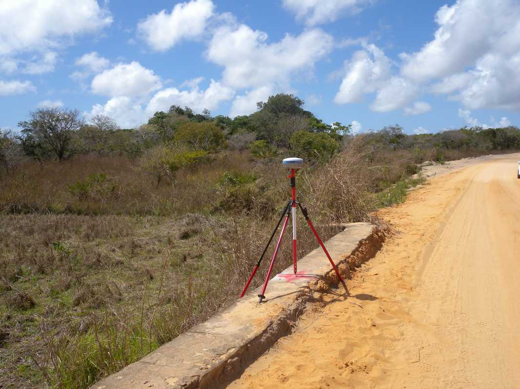
Site investigation and exploration to recover / identify existing geodetic benchmarks
Installation of tide station in a suitable position with internal datalogger and recording data for a period of about 12 consecutive days, from 23th September 2014 to 05 October 2014
Geodetic Network set up accordingly to the following phases:
- Monumentation of overall N. 45 new benchmarks as reference point for DGPS surveys and leveling activities;
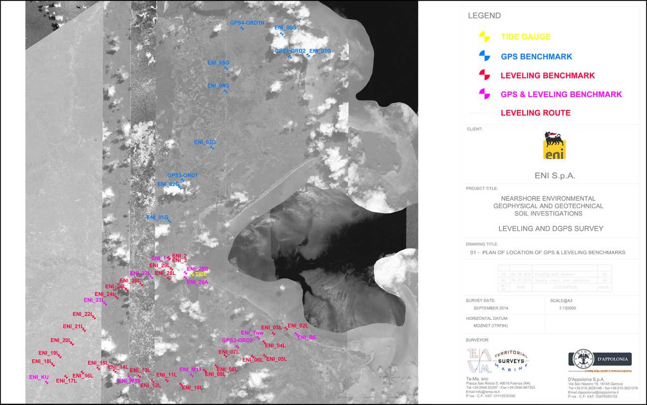
Geodetic Network survey by DGPS static methodology of every benchmarks;

High precision geodetic leveling, carried out Forward/Backward/Forward with Tolerance of T= 3 √D, starting from EEA Palma Camp to ENI-BE benchmark close to Anadarko’s BEACH reference point, for approximately 43 km of levelling route;

Post-processing of acquired dataset and output of results