Side Scan Sonar survey with interferometric BATHYSWATH 1, high performance system in shallow waters (swath width upto 15 times depth). This innovative system allows the acquisition of both bathymetric and sidescan sonar data. Post-processing with advanced statistical algorithms allows high resolution DTM generation and SideScan mosaicing.
Seabed classification and mapping with ROXANN Stereo System. The system provides seabed classification data to produce seabed bottom types maps. RoxAnn is able to discriminate more than 200 different seabed types (sand, silt, rock, seagrass etc).
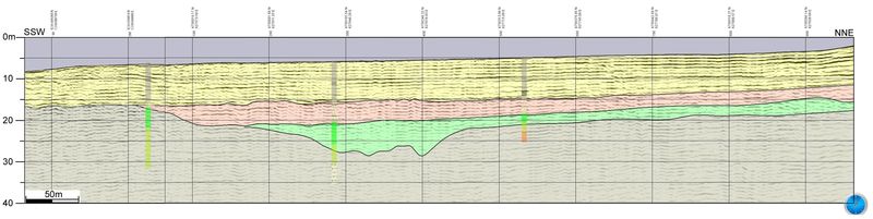
2D Seismic exploration with Subbottom Profiler 'chirp' EDGETECH 3100-P and towfish SB-424. Our technology applies full spectrum 'chirp' to create high definition image profile of subbottom structures, describing lithologic layers, thickness, geometries and indirect indications about sediments and stratigraphy of the investigated area.
2D Seismic exploration with Sparker GEO-SOURCE 200 and GEO-SENSE Mini-Streamer 24 channels. This technology applies full spectrum from 1.25 to 1.75 Khz to obtain a penetration upto 500m in the seabed, allowing the definition of lithologic layers, thickness, geometries and indirect indications with a resolution of 30cm.
Magnetometer surveys with Cesium marine Magnetometer GEOMETRICS G882 and FOERSTER Ferex 4032